The Pacific’s Vast Void: Unraveling the Deep Geological Mystery of Its Missing Continents
The Pacific Ocean is, by any measure, immense. Covering approximately 63 million square miles (165.5 million square kilometers), it accounts for nearly 30% of Earth’s total surface area. This colossal body of water is so vast. It will swallow all of Earth’s continents merged. Yet, there would still be room to spare. When we look at a world map, this sheer size prompts a fundamental question. Why does this enormous ocean so strikingly empty of continents? Why are there such distinct reasons for the absence of large landmasses in the Pacific Ocean? Most large landmasses clustered elsewhere. This leaves the Pacific as a vast expanse of seemingly uninterrupted water. This obvious lack of Pacific missing landmasses is not just a geographical curiosity. It is a puzzle rooted deep in the planet’s geological history. It is also influenced by ongoing processes.
The “emptiness” of the Pacific is not merely an absence of something expected. Instead, it is a defining feature linked to its unique geological identity. This characteristic is not a random quirk of geography but the outcome of specific, continuous geological forces. The Pacific appears “off” or unbalanced when viewed on a globe. This visual impression is a valid starting point for our inquiry. The ocean’s vastness suggests that if land distribution were purely random, the Pacific should logically host more continental land. The fact that it doesn’t indicates that systematic, powerful geological mechanisms are at play, shaping this distinct global asymmetry. This “emptiness” thus serves as an introduction to the dynamic and ever-changing nature of Earth’s crust.
First Observations: A Seemingly Barren Expanse
A casual glance at a world map or globe reveals a striking dichotomy. One hemisphere appears crowded with continents. The other is dominated by the singular, vast expanse of the Pacific Ocean. This visual disparity contributes to the perception of the Pacific as a “barren” or “vacant” space. This is especially true when considering large, continental-scale land. This perception isn’t entirely about a total lack of land. It shows that there is a significantly lower density of large, habitable landmasses. This is compared to the ocean’s enormous area.
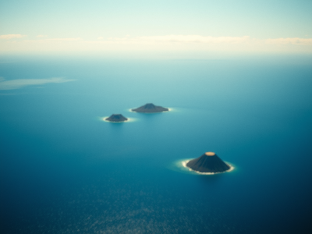
It is important to clarify, still, that the term “empty” is relative. The Pacific Ocean is far from being devoid of land altogether. In fact, it is home to an estimated 25,000 to 30,000 islands, more than any other ocean on Earth. Most of these islands are tiny. They are often volcanic in origin. Many are too small to even register on standard world maps. Their collective area is much smaller than the sheer volume of water. This contrast reinforces the visual sense of an ocean largely without continents. This nuanced understanding describes an ocean teeming with small islands. Yet, it lacks large continental bodies. This forms a basis for exploring the complex geological reasons behind this unique characteristic of Pacific Ocean Empty Continents.
Echoes Of Ancient Earth: Pangea, Panthalassa, And Drifting Landmasses
To understand the Pacific’s current state, we must journey back hundreds of millions of years. There was a time when Earth’s landmasses were not scattered as they are today. Instead, they were fused into a single, colossal supercontinent.
The Supercontinent Story: Pangea And The Panthalassa Ocean
This giant landform, known as Pangea, came into existence around 300 million years ago. Facts about Pangaea show its immense scale. Surrounding Pangea was a single, immense superocean called Panthalassa. This ancient ocean is the direct predecessor of the modern Pacific Ocean. As Pangea began to break apart, roughly 200 to 250 million years ago, Panthalassa started to shrink. This shrinkage eventually gave rise to the Pacific basin as we know it.
The formation and breakup of supercontinents like Pangea are part of a grand geological rhythm known as the supercontinent cycle. This cycle describes the periodic gathering and dispersal of Earth’s continental crust. This process unfolds over vast stretches of time. It typically takes 300 to 600 million years for a complete cycle according to GeoExPro on the supercontinent cycle. Recent research even suggests that this cyclical process of continental assembly and fragmentation, possibly involving earlier supercontinents like Columbia, might have initiated as far back as two billion years ago, profoundly shaping Earth’s geology over eons. The Pacific Ocean’s story is thus deeply intertwined with these ancient, planet-scale transformations.
The configuration of the Pacific, seemingly empty of continents, is therefore a direct inheritance from these ancient global reshuffles. It isn’t just any ocean; it stands as the primary remnant of Earth’s last superocean, Panthalassa. This historical context is vital: the supercontinent cycle demonstrates that such large-scale geographical changes are a normal part of Earth’s behavior. The Pacific’s apparent “emptiness” is thus not a static anomaly but a feature within a larger, ongoing geological narrative. Its immense size is, in part, because it represents what remained after the continents coalesced and then drifted apart again. The very idea of “missing continents” in the Pacific is framed relative to our current geological epoch, post-Pangea. During Pangea’s era, there was essentially one dominant ocean basin, underscoring that the present-day distribution of land and sea is a specific snapshot in Earth’s long, dynamic history.
Wegener And Continental Drift: A Revolutionary Concept
The notion that continents could move seems intuitive today, but it was a revolutionary idea in the early 20th century. In 1912, Alfred Wegener, a German meteorologist and geophysicist, published his theory of continental drift. He proposed that the continents were not fixed in their positions but had slowly “drifted” across Earth’s surface over millions of years. Wegener supported his theory with evidence such as the jigsaw-puzzle fit of continents like South America and Africa, fossil similarities across widely separated landmasses, and patterns of ancient climates.
Recommended Product
Amazon India – Shop Today's Best Offers
🛒 View on Amazon →As an Amazon Associate, we earn from qualifying purchases. Price and availability may vary.
Although Wegener’s ideas were initially met with considerable skepticism, primarily because he couldn’t definitively explain the mechanism driving the drift, his theory laid the groundwork for the modern understanding of plate tectonics. Eventually, his concept of moving continents became a cornerstone of geology. This scientific shift highlights how our understanding of Earth’s processes evolves. Continental drift is the direct explanation for the breakup of Pangea and the subsequent formation of the continents and ocean basins we recognize today, including the vast Pacific, which contributes to the phenomenon of Pacific Ocean Empty Continents. The continents are in a constant, albeit incredibly slow, state of flux, perpetually rearranging themselves across the globe.
The Engine Of Change: Understanding Plate Tectonics
The Earth’s surface is not a single, unbroken shell. Instead, it is composed of several large and numerous smaller tectonic plates. These are massive, rigid slabs of the Earth’s lithosphere, which includes the crust and the uppermost part of the mantle.
Earth’s Giant Puzzle Pieces: Introducing Tectonic Plates
These plates “float” or move upon the asthenosphere, a hotter, more ductile layer of the upper mantle beneath the lithosphere. It’s crucial to understand that both the continents we live on and the floors of the oceans are parts of these tectonic plates.
The primary driving force behind the movement of these plates is the immense heat emanating from the Earth’s core and mantle. This heat generates convection currents within the mantle, similar to how water circulates in a boiling pot. Hotter, less dense material rises, spreads out beneath the lithosphere, cools, and then sinks back down. This slow but powerful circulation drags the overlying tectonic plates along with it. One can visualize these plates as giant ice floes drifting on water or, perhaps more accurately, like items carried along on a series of enormous, slow-moving conveyor belts, a concept often illustrated in educational videos. This constant motion is responsible for shaping our planet’s geography, including the formation of mountains, oceans, and the occurrence of earthquakes and volcanoes.
Plate tectonics serves as the fundamental “operating system” for Earth’s surface geology. The perceived “emptiness” of the Pacific Ocean is not a passive condition but an active result of how this global system functions. Specifically, it’s the interplay between different types of plate boundaries on a worldwide scale that dictates the distribution of land and sea. The core concept that plate movement led to Pangea’s breakup directly connects to why continents are positioned as they are today, and why the Pacific appears to lack them, forming the basis of the Pacific Ocean Empty Continents question.
Types Of Plate Boundaries: Where The Action Happens
The interactions between tectonic plates occur primarily at their edges, known as plate boundaries. There are three main types of plate boundaries, each associated with distinct geological processes and features:
- Divergent Boundaries: These occur where two tectonic plates are moving away from each other. As the plates separate, molten rock, or magma, from the mantle rises to fill the gap. This magma cools and solidifies, creating new oceanic crust. This process is called seafloor spreading and is responsible for the formation and widening of ocean basins. A prime example of a divergent boundary is the Mid-Atlantic Ridge.
- Convergent Boundaries: These are zones where two tectonic plates are moving towards each other and colliding. The geological outcome depends on the types of crust involved:
- Oceanic-Continental Convergence: Dense oceanic plate subducts beneath a continental plate, forming trenches and volcanic mountains (e.g., Andes).
- Oceanic-Oceanic Convergence: Older, denser oceanic plate subducts beneath a younger one, creating trenches and volcanic island arcs (e.g., Aleutian Islands).
- Continental-Continental Convergence: Neither plate subducts easily; crust buckles to form massive mountain ranges (e.g., Himalayas).
- Transform Boundaries: At these boundaries, two tectonic plates slide horizontally past each other. No new crust is created, and old crust is not consumed. Friction causes earthquakes (e.g., San Andreas Fault).
The type of plate boundary is critical because it determines whether Earth’s crust is being created or destroyed. The Pacific Ocean is predominantly encircled by destructive (convergent) boundaries, whereas the Atlantic Ocean is characterized by a constructive (divergent) boundary. This fundamental difference is a key factor in explaining the Pacific Ocean Empty Continents reality.
Table 1: Key Geological Terms at a Glance
| Term | Simple Explanation/Analogy |
|---|---|
| Tectonic Plate | A massive, rigid slab of Earth’s crust and upper mantle; like a piece of a giant jigsaw puzzle or an ice floe on water. |
| Divergent Boundary | Where two plates move apart; like two conveyor belts moving in opposite directions, creating new floor in between. |
| Convergent Boundary | Where two plates collide; like a slow-motion car crash, or one conveyor belt going under another (subduction). |
| Subduction | The process where one tectonic plate sinks beneath another; like one rug being pushed under another. |
| Transform Boundary | Where two plates slide horizontally past each other; like two blocks rubbing side-by-side. |
| Seafloor Spreading | The formation of new oceanic crust at divergent boundaries as plates move apart. |
| Pangea | An ancient supercontinent that comprised most of Earth’s landmasses. |
| Panthalassa | The single, vast superocean that surrounded Pangea; the precursor to the Pacific Ocean. |
| Ring of Fire | A horseshoe-shaped zone of intense volcanic and earthquake activity encircling the Pacific Ocean. |
| Hotspot | A plume of hot material rising from deep within the Earth’s mantle, creating volcanoes as a plate moves over it. |
The Pacific Plate: A Giant Beneath The Waves And Its Role In The Geology Of Pacific Basin
The Pacific Plate is the undisputed giant among Earth’s tectonic plates, sprawling across an estimated 103 million square kilometers. A defining characteristic of this colossal plate is that it is composed almost entirely of oceanic crust.
Characteristics Of The Pacific Plate: Earth’s Largest Tectonic Plate
Oceanic crust is fundamentally different from continental crust: it is significantly denser, much thinner, and typically basaltic in composition, whereas continental crust is less dense, thicker, and predominantly granitic. These differences are crucial to understanding why the Pacific Plate behaves as it does and why we observe Pacific Ocean Empty Continents.
While the Pacific basin itself is ancient, having roots in the Panthalassa superocean, the crust of the Pacific Plate varies in age. Some of the oldest seafloor found on Earth, dating back to the early Cretaceous period (around 145 to 137 million years ago), is part of the Pacific Plate, and this ancient crust is actively being consumed in the deep ocean trenches at its margins. Due to the continuous process of seafloor spreading and subduction (recycling), oceanic crust is generally not older than about 200 million years. The Pacific Plate itself began to form approximately 190 million years ago. This massive plate is not static; it is in constant motion, generally moving in a northwesterly direction.
The inherent properties of the Pacific Plate—its vast size, its predominantly oceanic composition, and the age (and therefore density) of large portions of its crust—make it a prime candidate for subduction. The apparent absence of continents within its expanse is partly because the plate itself is not continental in nature and is geologically predisposed to being recycled back into the Earth’s mantle. Its immense perimeter means that its interactions with surrounding plates are numerous and significant, predominantly leading to its own consumption at subduction zones.
Formation And History Of The Pacific Plate
The Pacific Plate’s origin story begins around 190 million years ago, within the vast Panthalassa ocean. It formed from the destabilization of a triple junction—a point where three tectonic plates meet—involving the ancient Farallon, Phoenix, and Izanagi plates. This geological reorganization occurred as the triple junction evolved into an unstable configuration.
As the nascent Pacific Plate grew, it began to influence the fate of its neighboring plates. Its expansion led to the progressive consumption and reduction of the Farallon, Phoenix, and Izanagi plates. The Farallon Plate, for instance, was largely subducted beneath North America, leaving behind smaller remnants like the Juan de Fuca Plate. The Izanagi Plate was entirely consumed by subduction under Asia. This active role in “clearing out” or reconfiguring other oceanic plates has significantly contributed to the current geology of the Pacific basin. While predominantly oceanic, the Pacific Plate does carry some fragments of continental crust. Notable examples include parts of New Zealand (part of Zealandia), the Baja California peninsula, and sections of coastal California. These continental fragments are exceptions that highlight the plate’s otherwise oceanic character and the overarching theme of Pacific Ocean Empty Continents.
Table 2: Oceanic vs Continental Crust – Key Differences
| Feature | Oceanic Crust | Continental Crust |
|---|---|---|
| Typical Composition | Basaltic (rich in iron and magnesium) | Granitic (rich in silicon and aluminum) |
| Average Thickness | About 5-10 km (3-6 miles) | About 30-70 km (20-40 miles) |
| Average Density | About 3.0 g/cm³ (denser) | About 2.7 g/cm³ (less dense) |
| Typical Age Range | Relatively young (mostly < 200 million years) | Can be very old (up to 4 billion years) |
| Buoyancy | Less buoyant | More buoyant |
| Tendency at Convergent Boundary | Tends to subduct (sink) | Tends to resist subduction, often leading to mountain building |
Understanding these fundamental differences is vital for grasping why the Pacific Plate, being mostly oceanic, behaves as it does, especially concerning subduction. It also explains why continents, made of less dense continental crust, are largely absent from its interior.
The Ring Of Fire: Guardian Of The Pacific’s Emptiness And The Ring Of Fire Pacific Ocean
Encircling the vast Pacific Ocean basin is one of Earth’s most geologically dynamic and hazardous features: the Ring of Fire. This is not a literal ring of fire, but a roughly 40,000-kilometer long, horseshoe-shaped zone characterized by an exceptionally high concentration of active volcanoes and frequent earthquakes.
What Is The Ring Of Fire: A Zone Of Intense Geological Activity
This zone stretches along the western coasts of the Americas, across the Aleutian Islands, down through Japan, the Philippines, Indonesia, and into the New Zealand region. The intense geological activity of the Ring of Fire is primarily a consequence of convergent plate boundaries. Along these boundaries, the massive Pacific Plate, along with other smaller plates, is grinding against and diving beneath (subducting) adjacent continental and oceanic plates.
This constant, powerful interaction makes the Ring of Fire a hotbed of geological unrest. Astonishingly, this region is home to approximately 75% of the world’s active and dormant volcanoes and is the site of about 90% of the world’s earthquakes, including many of the most powerful seismic events ever recorded. The Ring of Fire is more than just a collection of volcanoes and earthquake zones; it acts as an active agent in maintaining the Pacific’s “emptiness” of continents. It forms a destructive boundary for the Pacific Plate itself and serves as a formidable barrier to any continental material that might otherwise drift into the Pacific basin. This continuous process of crustal consumption and the hazardous environment it creates are direct reasons why large, stable continents do not form or migrate into the Pacific’s heart, solidifying the state of Pacific Ocean Empty Continents.
Volcanoes And Earthquakes: Signatures Of The Ring Of Fire
The defining features of the Ring of Fire are its numerous volcanoes and frequent earthquakes, both direct products of the subduction process. As an oceanic plate descends into the Earth’s mantle, it heats up and releases water, lowering the melting point of the overlying mantle wedge, causing it to melt and generate magma. This buoyant magma then rises, eventually erupting to form volcanoes like Mount St. Helens and Mount Fuji.
Earthquakes in the Ring of Fire are caused by the immense stress and friction as tectonic plates collide. Plates can become locked, accumulating strain. When stress overcomes friction, the plates slip suddenly, releasing enormous energy as earthquakes. The catastrophic 2004 Indian Ocean earthquake and the 2011 T?hoku earthquake in Japan both occurred along subduction zones within this system. Recent USGS research into prehistoric Aleutian megaquakes further underscores the immense power of these subduction zones. The Ring of Fire vividly demonstrates Earth’s crustal recycling system, intrinsically linked to why the Pacific Ocean appears so devoid of large continents.
How The Ring Of Fire Contributes To The Pacific Ocean Empty Of Continents
The Ring of Fire plays a crucial role in explaining why the Pacific Ocean is empty of continents. It acts as a dynamic barrier. Continuous subduction along its margins consumes the Pacific Plate’s oceanic crust, “pulling” the seafloor downwards and inwards, preventing continental fragments from persisting within the central Pacific. If continental crust approaches a subduction zone, its buoyancy makes it resist subduction, often leading to accretion onto the overriding plate or complex collisions at the ocean’s edge, rather than entering the basin proper.
Furthermore, the Ring of Fire’s geological instability—frequent volcanic eruptions, powerful earthquakes, and tsunamis—makes the Pacific’s periphery hazardous. This turmoil is less conducive to the formation and stability of large landmasses compared to quiescent regions. Any smaller landmasses, like volcanic island arcs, are often geologically young and transient. Thus, the Ring of Fire is an active zone of crustal destruction, directly contributing to the phenomenon of Pacific missing landmasses.
Why No Continents In The Pacific: The Science Explained And Reasons For Pacific Continent Absence
A primary reason for the Pacific Ocean Empty of Continents lies in the overwhelming dominance of subduction zones around its perimeter.
The Dominance Of Subduction: The Pacific As A Closing Ocean Basin
As highlighted by the Ring of Fire, the Pacific Plate is being consumed along these convergent boundaries at a significant rate. Oceanic crust, especially older, denser sections, is readily pulled beneath adjacent plates, recycling the oceanic lithosphere into the mantle. Because the destruction rate of oceanic crust at these subduction zones generally exceeds its creation rate within the main Pacific basin (e.g., East Pacific Rise), the Pacific is broadly considered a shrinking or “closing” ocean basin.
This “emptiness” is a direct consequence of its maturity as an ocean basin and the specific type of crust that forms its plate. Older oceanic basins tend to be encircled by subduction zones because their crust has had time to age, cool, and increase in density, making it gravitationally unstable. The Pacific Ocean, an ancient basin with an enormous oceanic plate, fits this model perfectly.
Comparing Pacific And Atlantic Tectonic Settings
The contrast between the Pacific and Atlantic Oceans’ tectonic settings starkly illustrates why one appears “empty” of continents while the other is flanked by them:
- Atlantic Ocean: A younger ocean basin, formed from Pangea’s breakup. Its dominant feature is the Mid-Atlantic Ridge, a divergent boundary where new oceanic crust is created, pushing continents apart and widening the Atlantic. Subduction zones are minor.
- Pacific Ocean: While it has spreading centers like the East Pacific Rise, its margins are overwhelmingly convergent (Ring of Fire). It’s much older, a remnant of Panthalassa, with geological roots possibly tracing back to Rodinia’s breakup. This age has allowed its crust to become dense and prone to subduction.
This fundamental difference—Atlantic opening, Pacific closing—is a core reason for the contrasting presence of continents and the reality of Pacific Ocean Empty Continents.
Why New Continents Don’t Form In The Pacific
Several geological reasons explain why new continents don’t form within the Pacific:
- The Ring of Fire as an Impenetrable Barrier: Intense subduction prevents buoyant continental crust from accreting or drifting into the central Pacific. Approaching continental fragments are more likely scraped off onto overriding plates or involved in collisions at the ocean’s edge.
- The Pacific Plate’s Intrinsic Nature: Composed predominantly of dense oceanic crust, it doesn’t readily allow external continental landmasses to encroach. Processes within the Pacific Plate (like seafloor spreading) generate more oceanic crust, not the vast volumes of silica-rich, less dense material needed to build a new continent.
The geological mechanisms for creating continents (e.g., accretion of buoyant crustal terranes) are largely absent in the central Pacific or overwhelmed by dominant subduction at its periphery. Volcanic island arcs and oceanic plateaus form, but they are distinct from true continents in scale, composition, and stability.
Table 3: Pacific vs Atlantic – A Tale of Two Ocean Basins
| Feature | Pacific Ocean | Atlantic Ocean |
|---|---|---|
| Primary Tectonic Regime at Margins | Predominantly Convergent (Subduction Zones – Ring of Fire) | Predominantly Passive Margins, with a major Divergent Boundary (Mid-Atlantic Ridge) |
| Age of Basin | Very Old (remnant of Panthalassa, >200 million years, parts much older) | Relatively Young (formed with Pangea’s breakup, ~200 million years) |
| Predominant Crust Formation/Consumption | Dominated by crust consumption at margins | Dominated by new crust formation at the central ridge |
| Presence of Major Mid-Ocean Spreading Ridge | Yes (e.g., East Pacific Rise), but margins are consuming | Yes (Mid-Atlantic Ridge), driving ocean expansion |
| Dominance of Subduction Zones | High, encircling much of the basin | Relatively few and localized (e.g., Caribbean, Scotia arcs) |
| Overall Trend (Expanding/Shrinking) | Generally Shrinking (“Closing” Ocean) | Expanding (“Opening” Ocean) |
| Typical Pacific Ocean empty continents status | Largely empty of continents due to consumption and barrier effects | Flanked by continents that are drifting apart |
Expand Your Knowledge: Further Learning & Resources
(Referral links included in this section. These help support Newspatron at no extra cost to you.)
Understanding the intricate processes that shape our planet can be a rewarding journey. These processes include the ones dictating why the Pacific Ocean is empty of continents. For those looking to delve deeper, several excellent resources are available:
- Foundational Understanding of Plate Tectonics: Start with Peter Molnar’s “Plate Tectonics: A Very Short Introduction“. It’s available in (Kindle Edition). You can also find its Paperback version. This book offers a succinct yet authoritative account of the mechanisms of plate tectonics and its profound impact on our understanding of Earth.
- Comprehensive Physical Geology: For a more detailed exploration of Earth’s geological processes, textbooks like “Earth: An Introduction to Physical Geology” (various editions by authors like Tarbuck, Lutgens, and Tasa are available via this link) serve as invaluable references. These texts typically cover everything from minerals and rocks to large-scale tectonic movements.
- Oceanographic Insights: To specifically understand ocean basins like the Pacific, consider a text such as “Essentials of Oceanography” (look for editions by Trujillo & Thurman, or Garrison, available through this link). These books delve into the formation, features, and processes of the world’s oceans.
- Visualizing Earth’s Structure: Abstract concepts can often be better understood with visual aids. 3D Earth Models that showcase tectonic plates, or demonstrate the Earth-Sun-Moon system like the “Smartivity Earth-Sun-Moon Space Toy,” can be fantastic educational tools for learners of all ages. Models depicting Earth’s internal structure (core, mantle, crust) are also highly illustrative.
- Hands-on Exploration Tools: For those inspired to explore geology more tangibly, consider tools like a Hand Lens or Magnifying Glass for examining rock and mineral specimens. While this article focuses on large-scale ocean basin geology, the principles are built from understanding Earth’s materials. For outdoor geological observations, a good pair of Binoculars can also be a useful companion.
Islands Galore But No Continents: The Pacific’s Landforms And The Pacific Lacks Large Land
It is crucial to reiterate that the statement “the Pacific Ocean is empty” is a simplification. This statement refers to the absence of large continental landmasses. The Pacific is, in fact, teeming with islands.
An Ocean Of Islands, Not Continents
Estimates suggest it contains between 25,000 and 30,000 islands, more than any other ocean. These islands vary greatly: low-lying coral atolls, uplifted limestone islands, and towering volcanic high islands. However, most are incredibly small compared to the ocean’s scale. Many result from underwater volcanic eruptions, either along island arcs at subduction zones or over hotspots. Their collective landmass is insignificant compared to a continent. This contributes to the perception that the Pacific Ocean Empty Continents is its defining trait. It also suggests that the Pacific lacks large land. The Pacific’s “land” is predominantly localized volcanic constructions, not large-scale accretions of buoyant continental crust.
Hotspot Volcanism: The Making Of Island Chains Like Hawaii
Beyond island arcs, hotspot volcanism is another significant source of Pacific islands. Hotspots are considered plumes of exceptionally hot mantle material. They rise from deep within the Earth, possibly from the core-mantle boundary. These plumes are relatively stationary, while tectonic plates glide over them. As a plate, like the Pacific Plate, moves over a fixed hotspot, the plume melts the lithosphere. This process generates magma that erupts to form volcanoes. A chain of volcanoes forms. The youngest volcano is over the hotspot. Older ones stretch in the direction of plate motion. The Hawaiian Islands and Emperor Seamount chain are classic examples.
While hotspot-generated islands can be substantial, their crust is typically oceanic (basaltic), not the thicker, less dense continental crust. Recent research highlighted by Earth.com on Pacific volcanoes and Business Today’s visual story on Earth’s largest volcano twin discusses massive hotspot-related volcanism. It includes the Louisville hotspot track and the Ontong-Java Plateau. This plateau is a Large Igneous Province. It is an enormous accumulation of volcanic rock. It remains an oceanic plateau, not a continent.
Zealandia: The Almost Continent – A Case Study
Zealandia (Te Riu-a-M?ui) is a fascinating case study. It is a largely submerged continental fragment in the southwest Pacific. It encompasses New Zealand and New Caledonia. It’s predominantly continental crust, thicker and less dense than the surrounding Pacific Plate’s oceanic crust. Originating from Gondwana, Zealandia rifted away and underwent significant stretching and thinning, causing about 94% of its ~4.9 million sq km area to subside below sea level. Only New Zealand and New Caledonia remain as significant emergent landmasses. Zealandia highlights that continental crust does exist in the Pacific. However, the region’s dynamic tectonics, including crustal thinning and subsidence, often prevent these fragments from remaining large and elevated. This process reinforces why the general state is Pacific Ocean Empty Continents.
Challenges For Landmass Stability And Development In The Pacific
Beyond primary geological reasons, other factors contribute to the Pacific’s perceived “emptiness” and influence its landmasses:
- Geological Instability: The Ring of Fire makes many areas prone to volcanic eruptions, earthquakes, and tsunamis, challenging long-term settlement.
- Vast Distances: Immense distances between island groups historically made travel and communication difficult.
- Small Island Size and Resource Limitations: Most islands are small and have limited freshwater. Arable land is scarce, and the terrain is rugged. These factors make large-scale development challenging. Geographic isolation and limited natural resources compound issues for many Pacific island nations.
These factors, combined with geology, contribute to the human perception of the Pacific. Though geologically fascinating, its scattered, often small and vulnerable islands don’t register globally like large, stable continents.
Peering Into The Depths: Recent Discoveries And Ongoing Research About The Geology Of Pacific Basin
Ongoing research continually refines our understanding of the Pacific Ocean’s complex geology. This research reveals intricacies that explain why the Pacific Ocean Empty of Continents is a prominent planetary feature. The apparent “emptiness” belies a rich geological tapestry beneath its waters.
Uncovering Ancient Secrets: The Farallon Plate And Cratonic Drips
Recent research offers insights into the lasting impacts of Pacific tectonic processes. A study highlighted by Daily Galaxy on North America’s crust and Earth.com on ‘dripping’ rock blobs likely references similar findings. These are from a hypothetical April 2025 Nature Geoscience paper mentioned in the source text. It revealed that remnants of the ancient Farallon Plate still influence North America. The Farallon Plate largely subducted beneath North America. Scientists found rock “dripping” from the underside of the North American craton. This phenomenon is possibly due to the subducted Farallon slab interacting with the continent’s base, deep in the mantle. This indicates that subducted Pacific oceanic material can alter continents from below. It highlights the deep connections between surface tectonics and mantle processes.
Connecting The Dots: Louisville Hotspot And Ontong Java Plateau
Another advancement (hypothetically from a Nature April 2025 paper in the source text, and related to the previously cited Earth.com/Business Today articles) connects the Louisville Seamount Chain and Ontong-Java Plateau. Research established a link between the Louisville hotspot and both the underwater Louisville mountain chain and the colossal Ontong-Java Plateau. Scientists revised the Pacific Plate motion models. They based this on rock sample analysis from an older segment of the Louisville volcanic track. Their conclusions showed that the same mantle plume was responsible for creating both features. This provides a more complete history of Pacific basin evolution. It enhances understanding of how Large Igneous Provinces (LIPs) like Ontong-Java form. These are vast magma outpourings distinct from continents.
Listening To The Past: Aleutian Megaquakes And Tsunami Threats
The Ring of Fire’s immense power is reaffirmed by research into its past. Recent USGS studies on Aleutian megaquakes analyzed coastal sediments for ancient tsunami evidence, reconstructing powerful earthquakes (some >Mw 8.5) in the eastern Aleutians over the past 700 years. Tsunamis from these megaquakes propagated across the Pacific, inundating shorelines as far as Hawaii. A 14th-century event may have produced tsunami inundation in Hawai?i exceeding the 1957 tsunami. This research is crucial for understanding subduction zone hazards. It highlights that historical records may not capture the true scale of events. This improves tsunami hazard assessments for Pacific coastal communities.
Exploring The Unknown: NOAA’s Pacific Expeditions And The Pontus Plate Discovery
Vast Pacific regions remain unexplored. Organizations like NOAA map these territories, discovering new geological features and deep-sea ecosystems. NOAA’s Okeanos Explorer uses ROVs and sonar mapping, uncovering seamounts, fracture zones, and hydrothermal vents. Research (hypothetically from Gondwana Research 2023 in source text) announced they reconstructed a massive, previously unknown tectonic plate named “Pontus.” This plate was once about one-quarter the Pacific’s size. It existed for at least 150 million years before subduction. Its remnants were identified in mountain belts in Borneo and the Philippines. The Pontus plate discovery shows how much Pacific geology is still being pieced together.
The Twitter-Sphere Buzz: What Scientists Are Discussing
Pacific geology discussions are vibrant on social media. @USGSVolcanoes shares eruption updates; @NOAAOcean posts deep-sea ROV highlights. Scientists discuss new animations of Farallon plate subduction or debate Zealandia’s extent based on new seafloor mapping. These digital conversations provide easy-to-understand updates on the tectonics of the Pacific seafloor. They explain why the Pacific Ocean is empty of continents.
The Ever Changing Pacific: A Glimpse Into The Future
The geological forces shaping the Pacific and causing the Pacific Ocean Empty Continents phenomenon are ongoing. Plate tectonics is continuous; Earth’s surface is in constant, slow motion.
The Ongoing Geological Ballet: Will A New Supercontinent Form In The Pacific?
Geologists theorize that over the next 200 to 250 million years, continents will reassemble into a new supercontinent. This is part of the supercontinent cycle. “Amasia” suggests the Americas and Asia drift north, closing the Arctic. “Pangaea Proxima” envisions the Atlantic closing, bringing the Americas back to Africa/Eurasia, with Australia colliding with Asia. In many scenarios, the Pacific continues to shrink as continents converge. The current “emptiness” is likely a temporary phase. The forces maintaining its continent-free status—subduction along the Ring of Fire—also drive its future transformation.
Potential Futures For The Pacific Ocean: Empty Of Continents No More, Or Even Emptier?
- The Pacific Closes: If subduction continues and continents converge, the Pacific will eventually close entirely. Continents would collide within the former Pacific basin, forming a new mountain range. The Pacific Ocean would cease to exist.
- A Shift in Tectonics: Less, but global tectonics will shift. New rifting zones develop within the Pacific Plate. Boundary interactions change. This will form new, smaller ocean basins. It also accretes landmasses if subduction ceased in areas. However, current momentum favors a continued “closing” phase.
The Earth remains dynamic. The processes that resulted in Pacific Ocean Empty Continents will inevitably reshape it.
Concluding Thoughts On This Grand Geological Puzzle
The vast, blue expanse of the Pacific Ocean seems devoid of large continents. This is a direct consequence of billions of years of relentless geological activity. The story of the Pacific Ocean is inscribed in plate tectonics. It spans from the breakups of supercontinents like Pangea and the legacy of Panthalassa. The Pacific Plate has unique features. This feature is an old, cold, dense oceanic crust destined for recycling. ?
The fiery Ring of Fire Pacific Ocean has intense volcanic and seismic activity. It testifies to powerful subduction processes encircling the Pacific basin. These consuming margins act as dynamic barriers, preventing continents from encroaching and pulling the Pacific seafloor into Earth’s mantle. This contrasts with the younger, widening Atlantic.
While the Pacific hosts thousands of islands and the submerged Zealandia, these aren’t expansive continents. The Pacific Ocean Empty Continents reality is a tale of crustal consumption. It reflects an ancient lineage. It also involves the ceaseless dance of tectonic plates. Exploring its depths deepens our appreciation for the immense forces. We also appreciate the vast timescales shaping our ever-changing planet. This reminds us the world map is a fleeting moment in Earth’s geological saga.
[https://docs.google.com/document/d/1UlnC3V4bgDI9VsAqtox3AhTrjUrgWNx8uvyp1-bSa6Y/edit?usp=sharing]
The story of our Earth is written in its rocks and oceans, a dynamic tale stretching over billions of years. The Pacific’s vast ’emptiness’ is just one chapter, revealing the incredible power of plate tectonics. What geological wonder of our planet fascinates you the most? You have a theory about the Pacific’s future, or a question about another earthly mystery? ? I’m Kumar, Editor at Newspatron, and I’m always keen to hear your thoughts and perspectives.
Share Your Insights: Drop a comment below!
Stay Updated & Quick Bites: Follow me on Instagram, X (formerly Twitter) (@Newspatron). Check out our YouTube channels for visual explorations. Visit DroneMitra – ‘Your Sky is Digital with a Drone as a Friend’. Explore Newspatron – ‘Let Curiosity Be Your Guide’. You can also find discussions on Reddit (r/Newspatron).
Deeper Dives & Community: My Facebook profile is open to new friends! Feel free to send a friend request from your authentic profile (no fakes, please!). Or, like the Newspatron Facebook page to keep up with all our latest content.
Visual Journey: For captivating science and nature imagery, follow me on Tumblr (newspatron.tumblr.com).
Instant News: Subscribe to my WhatsApp Channel for immediate updates. Don’t worry about your privacy. I only see the subscriber count.
Quick Chats: Connect instantly on Telegram (@KumarNewspatron) for science discussions.
Never Miss A Post: Subscribe to our RSS feed.
Professional Network: Let’s connect on LinkedIn (Kumar Newspatron) and share industry insights.
You can find all these links on the Newspatron homepage. Looking ahead to our geological conversations!
